Showing posts with label google maps. Show all posts

ALGERIA - Tipaza

Posted by ADeeL JAviD In , , , , , ,


Algeria is home to several World Heritage Sites, including the fascinating town of Tipaza. Once a Roman military colony, Tipaza has some fascinating ruins. Nestled among trees and palms are the remains of the town's Great Basilica, its Roman baths and amphitheatre, and  numerous mosaics.

Tipaza (formerly Tefessedt, Chenoua:  Bazar, Arabic: تيبازة‎) is a Berber-speaking town on the coast of Algeria, capital of the Tipaza province. The modern town, founded in 1857, is remarkable chiefly for its sandy beach, and ancient Berber and Roman ruins.

Modern era
Near Tipaza at 36°33'58"N 2°28'50"E, there is Tipaza longwave transmitter, a facility for broadcasting a French speaking program on the longwave frequency 252 kHz, which can be well received in many parts of Europe.

Another Roman town of the same name
Another town which was called Tipasa, in Latin Timesis, was located in Constantine Province, 88 km (55 mi) due south of Annaba, 957 m above the sea; it is now called Tifesh. The chief ruin is that of an extensive fortress, the walls of which are 3 m thick.


ALBANIA - Thethi National Park


                                                               Click images to enlarge


The isolated and remote Thethi National Park is located in the far north of Albania in the Dinaric Alps. The park and valley consists mostly of beech forest with some conifers and broad-leafed trees such as ash and hornbeam.

The largest settlement in the area is the pretty village of Thethi which during the height of communism was a tourist resort. Adventurous travellers who make it to Thethi are amply rewarded – the setting is quite dramatic with a backdrop of the high peaks of the Albanian Alps.

Shkodra is the nearest major town to Thethi, 70 km away. Due to the poor road conditions and remoteness of the region, hiring a 4WD vehicle with an experienced driver is the recommended and most reliable way to travel – and an adventure in itself!

ALBANIA - Llogara National Park


                                                               Click images to enlarge


Llogara National Park is located along the ridge of cliffs between the coastal towns of Vlora and Himara. The park is covered by dense black pine forests and gives rise to a 1,027m pass – ‘the Llogara Pass’. The park is rich in wildlife, in particular with roe deer, squirrels, foxes, wolves and wild boar.


Walking is a popular activity in Llogara and the park is an ideal location for sky activity pursuits such as parachuting.

ALBANIA - Lake Ohrid 'Deepest Lake on the Balkan Peninsula'


                                                               Click images to enlarge


Located in eastern Albania/western Macedonia and bisected by the Macedonian/ Albanian border, the 367 sq. km Lake Ohrid is the deepest lake on the Balkan Peninsula with an average depth of 138m and a maximum of 294m. It is also a popular summer holiday and hiking destination for Macedonians, Albanians and other eastern Europeans.


With its tectonic origins as a result of movements in the earth’s crust, Ohrid has a rich marine environment and is home to some unique species of fish – including the speckled trout. One of the best ways to explore the Lake Ohrid region, either in Albania or Macedonia is by mountain-bike.

ALBANIA - Apollonia 'Ruined Corinthian City'


                                                               Click images to enlarge


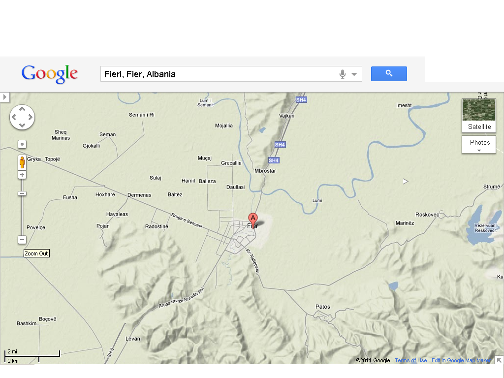
The ruined city of Apollonia is a 20 minute drive from the small Albanian town of Fieri and is certainly worth a stop when travelling en route between Tirana and the south. Although the site is not particularly extensive, the rural location is beautiful – set amongst hills and fields. It was founded by Corinthian colonists around 600 BC and at that time was a vibrant port. In the years from 214 BC onwards the city was involved in the war between the Illyrian Taulanti and Casander, the King of Macedonia. In 229 BC the city came under Roman control. In 148 BC it was integrated into the province of Macedonia.
Two significant structures remain at Apollonia – the façade of a Roman bouleuterion with its elegant columns and a small Roman theatre complete with original seats. Attached to the site near the entrance is a 13th century Byzantine monastery.

ALBANIA - Shkodra

Posted by ADeeL JAviD In , , , , ,


                                                                Click images to enlarge


Located close to the northwest border with Montenegro, Shkodra is one of the oldest towns in Europe and is the third largest town in Albania. Three rivers converge here – the Drini, the Kiri and the Buna. The town also serves as a suitable start-point and base for more adventurous journeys into the remote far north of Albania.

In the 3rd century BC Shkodra was the capital of the Illyrian Kingdom of the Ardians (whose queen was the legendary Teuta). Roman occupation was followed by Byzantine, Venetian and Turkish Ottoman rule. It was the Venetians who left their mark on the city after almost 100 years of rule and nowadays Italian is widely spoken. The city is also the centre of Catholicism in the country.

ALBANIA - Kruja 'Skanderbeg’s City'


Click Images to enlarge

Set against a backdrop of the almost vertical limestone wall of the Kruja mountains, the small town of Kruja is known by many as the ‘Balcony of the Adriatic’. Kruja's mountain citadel affords magnificent views of the surrounding region and across the coastal plains to the sea.Built on as isolated spur of limestone at a height of 548m, Skanderbeg’s castle is the main place of interest in the town. Within its grounds are two interesting museums. Although small, Kruja Bazaar is also worth exploring with its single street of quaint shops which have undergone extensive restoration. The castle area has a couple of restaurants and provides an ideal place to relax and take in the wonderful views.

AFGHANISTAN - Panjshir Valley


                                                               Click images to enlarge

Panjshir Valley is undoubtedly the most beautiful region in Afghanistan. The Valley, located about 60 miles from Kabul, Panjshir Valley is known for its fascinating landscape and possesses great potential for trekking. The Valley, which stretches for 62miles to the Anjoyman Pass, has been the centre of Afghan resistance against the invading Soviets and the ultra-conservative Taliban.
Mausoleum of Ahmed Shah Masood, the legedanry mujahedin fighter and Afghan national hero, lies in the Panjshir Valley. The Mausoleum is nothing less than a pilgrimage centre for the visitors. Masud, a brilliant military strategist, foiled nine Russian attempts to conquer Panjshir Valley. He continued his struggle against the Taliban until he was assassinated in a terrorist attack in 2001.